Our Capabilities
Engineering, survey and project systems for mining and infrastructure delivery in West Africa.
Mining and infrastructure projects in West Africa demand practical engineering support, reliable field data and controlled project delivery — from teams who understand both international standards and local conditions. SITEC provides that capability across engineering, survey and project systems — so your project is technically sound, built to specification and documented to the standards your stakeholders require.
Engineering & Technical Solutions
Practical technical support for project owners, EPCM/PMC teams and contractors — from design verification through construction oversight to final documentation.
Our engineers embed directly with project teams to maintain technical control across disciplines. Whether you require independent review of a contractor's design package, on-site engineering oversight during construction or multidisciplinary coordination across civil, structural, mechanical, electrical and piping — SITEC provides engineers who apply international standards and codes and deliver to your project's requirements.
Applicable to gold mining, process plant and infrastructure projects in West Africa.
Design Verification & Technical Review
Independent verification of designs, calculations and specifications against international codes and project requirements. Deficiencies are identified and resolved before construction, significantly reducing costly site rework.
On-Site Engineering Oversight
Qualified engineers deployed to site to supervise technical execution, resolve construction challenges and ensure work is performed to approved designs and specifications.
Multidisciplinary Coordination
Technical coordination across civil, structural, mechanical, electrical and piping disciplines — ensuring interface management and design integration throughout project delivery.
Feasibility & Study-Phase Engineering
Engineering inputs to feasibility studies, technical risk assessments and design basis development — establishing sound technical foundations before construction commitments.
Technical Documentation & Compliance Records
Engineering reports, inspection records, as-built documentation and compliance verification constitute the auditable trail that demonstrates project integrity.
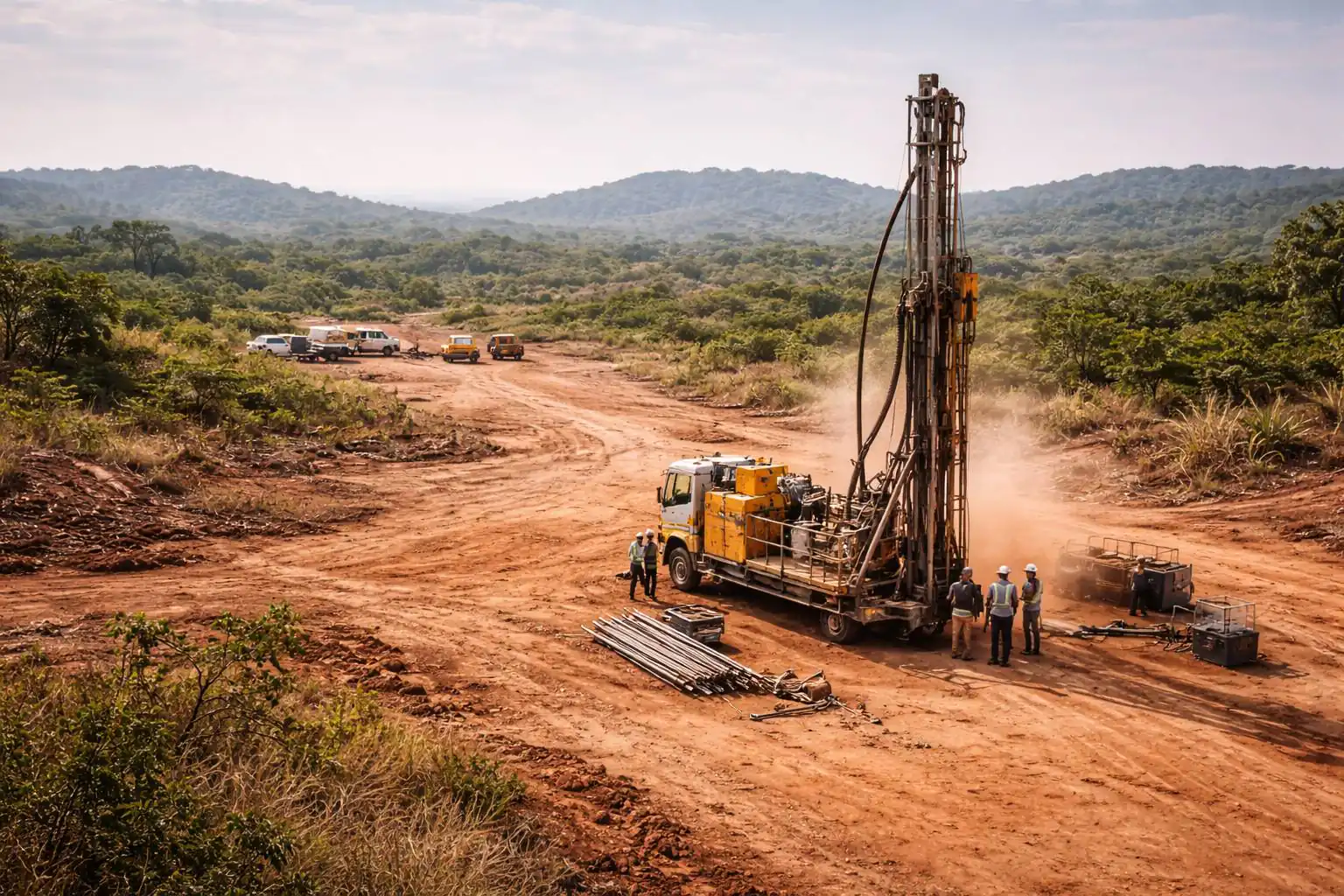
Survey & Geomatics Solutions
Reliable field data for design, construction, verification and progress control — delivered in engineering-ready formats. Aerial survey, drone mapping and geospatial services are delivered through SitecFly, a division of SITEC SARL.
Every engineering project requires accurate terrain data before design can proceed. SITEC provides that data through integrated ground survey (GNSS and total station), drone photogrammetry, airborne LiDAR (around 3 cm vertical accuracy) and GIS analysis. Deliverables are provided in industry-standard formats — LAS/LAZ, GeoTIFF, DWG/DXF, Shapefile, KMZ — ready for direct use by your engineering and design teams. All survey deliverables are referenced to the project coordinate system and geoid, established from GNSS/RTK or PPK (post-processed kinematic) ground control and verified against independent checkpoints.
Centimetre-grade airborne photogrammetry and LiDAR · GNSS/RTK · Engineering-grade deliverables in LAS/LAZ, GeoTIFF, DWG/DXF. Deployed across mine sites, transmission line corridors and infrastructure projects throughout West Africa.
GNSS Control Networks & Topographic Surveys
Establishment of geodetic control networks and detailed topographic surveys using GNSS and total station — providing the precise base data for engineering design and construction layout.
Drone Photogrammetry & Aerial Mapping
Rapid aerial mapping of large sites that feeds your studies directly: orthomosaics, surface models and point clouds delivered with engineering-grade accuracy.
Airborne LiDAR Scanning
Engineering-grade terrain data where photogrammetry cannot penetrate — under canopy, along corridors and across complex terrain. Corridor surveys of tens of kilometres delivered in a matter of days.
Transmission & Distribution Line Inspection
Drone-based inspection of HV/MV/LV transmission and distribution lines — visual assessment of towers, insulators and conductors, thermal hotspot detection and vegetation encroachment analysis along corridors. Deliverables include annotated inspection reports, defect logs, thermal imagery and GIS-compatible datasets.
GIS Data Management & Analysis
Your field data becomes structured intelligence: spatial databases, thematic mapping and analysis in support of project planning and operational decisions.
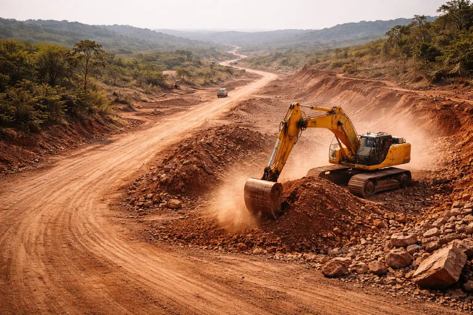
Volume Calculations & Earthworks Monitoring
Stockpile measurement, excavation tracking and progress verification through precise cut-and-fill computation — the basis of project control and payment certification.

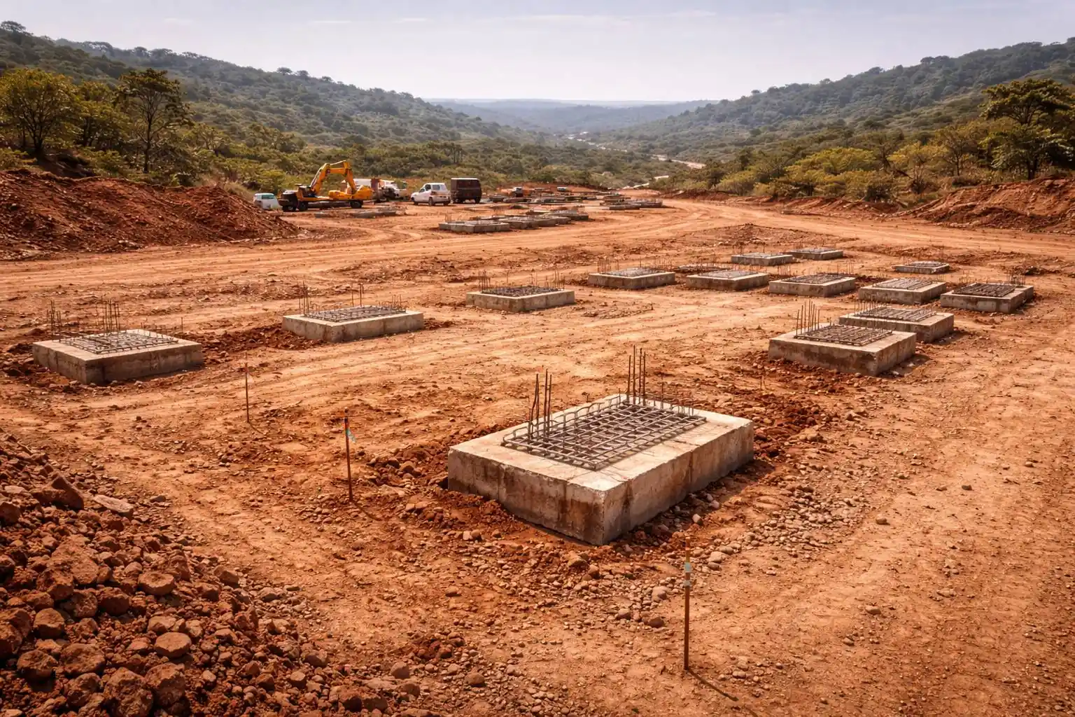
Project Delivery & Construction Support
Client-side project delivery, construction supervision and project controls that keep execution on track regardless of site conditions.
Effective construction delivery requires disciplined controls, qualified supervision and proactive risk management — especially in West Africa's demanding operating environments. SITEC provides experienced project controllers and construction supervisors with direct experience across mines, processing plants, industrial facilities and linear infrastructure throughout the region. We understand the local challenges — unpredictable supply chains, remote site logistics, multiple subcontractor interfaces — and we have the systems and people to manage them.
Applicable to mine expansions, industrial facilities and linear infrastructure across West Africa.
Project Controls & Earned Value
Schedule management, cost tracking, earned value analysis and progress reporting — providing clear visibility of project performance against baseline at all times.
Construction Supervision & Quality Management
Qualified supervisors on site verifying workmanship, enforcing approved methods and ensuring contractor performance meets specifications and quality standards.
HSE Management & Regulatory Compliance
Implementation and enforcement of health, safety and environmental management systems — promoting a zero-harm culture and supporting regulatory compliance throughout construction.
Procurement Coordination & Site Logistics
Material procurement tracking, expediting and site logistics management — helping the right materials reach remote sites on schedule to maintain construction momentum.
Commissioning, Handover & Closeout
Systematic pre-commissioning, commissioning, punch-list resolution and handover management — delivering a facility that is ready to operate with complete documentation.

Contractor Readiness & Business Systems
The systems that make contractors credible on paper — procedures, documentation and project controls that formal mining and infrastructure projects require.
Many capable contractors in West Africa lose work — not because they cannot do it, but because they cannot prove it on paper. SITEC bridges that gap: we help contractors build the management systems, HSE frameworks, tender documentation and mobilisation plans that project owners and EPCM teams require before they will award work. The same capability applies to project owners who need to formalise their own vendor evaluation, contract administration and document control.
Supporting local and regional contractors across West Africa to compete on formal tenders.
Tender Documentation & Bid Support
Preparation of compliant tender responses — method statements, resource plans, CVs, HSE submissions and commercial schedules that meet prequalification and bid evaluation criteria.
Management Systems & HSE Frameworks
Development of quality management systems, HSE plans and operational procedures to the standards required by international mining and infrastructure clients.
Vendor & Contractor Evaluation
Assessment of contractor capability, financial standing and systems readiness — supporting project owners in building a qualified and reliable supply chain.
Contract Administration & Document Control
Structured systems for correspondence, submittals, variations, progress claims and project records — keeping the contractual interface clean and auditable.
Mobilisation Planning & Capacity Building
Site mobilisation planning, resource scheduling and on-the-job capability transfer — preparing teams to perform from day one on formal project sites.
Ready to Discuss Your Requirements?
Outline your project scope and technical requirements — SITEC will define the right capability package for your delivery.